PeCAN, along with three other community groups, have objected to amendments to plans for the Penns Field Site which is off Heathfield Road in Petersfield, and called 'Alderbrook' by the developer.
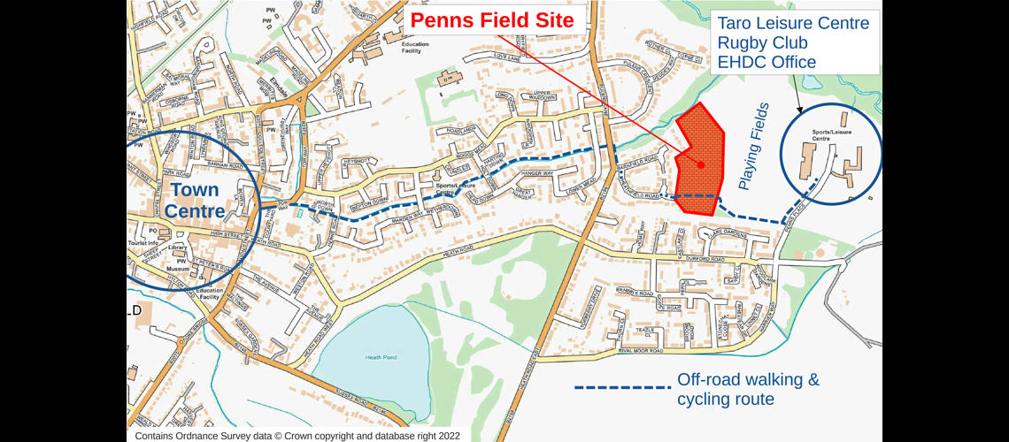
For the first time, the new plans reveal cycle routes across the Penns Field site, including routes that can be used by the local community to reach the town’s sports facilities and the Leisure Centre. However, we are dismayed that the proposed route is both unsafe and inferior to the route it will replace.
Approximately 20 years ago, a shared footpath and cycleway was constructed from Heathfield Road to the Taro Leisure Centre, crossing Penns Field. This was a segment of a route connecting the Town Centre to the Leisure Centre. It has become a key strategic off-road walking and cycling route in Petersfield and is identified as such in some official planning documents, for example in the Petersfield Neighbourhood Plan. When Kebbell Homes started construction on the Penns Field site in September 2021, the established route was blocked by a barrier and a temporary footpath was provided.


According to the developer’s plans, in the future, cyclists will be able to follow a route which approximates to the long established route but is inferior for several reasons, which are briefly summarised below:
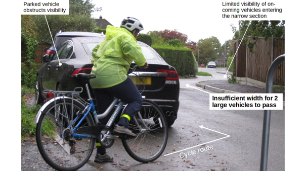
- Cyclists and vehicles will share a 40 metre narrowing of Heathfield Road, which expects to see up to 50 vehicle movements per hour. This creates a situation where cyclists will be intimidated by traffic and squeezed into the kerb.
- Eastbound cyclists will be at risk because of poor visibility at the ninety degree bend on the new road through the site.
- We are concerned that the dropped kerbs will be poorly constructed, in a manner contrary to national and local guidance, thus putting cyclists at risk of injury.
The plans show an alternative route via Barnfield Road, but the problems on this route are:
- It is mainly on-road and exposes cyclists to vehicles reversing onto the carriageway.
- It is likely to be congested with parked cars.
- A section of route near Barnfield Road will be unlit. This section will be under the control of an unspecified management company, instead of the Highway Authority. We are concerned that parked cars will block the movement of pedestrians, cycles and emergency vehicles.
Image shows poor visibility for cyclists on Heathfield Road from the western end of the access road into the new development.

Replacing the long established and recognised route with an inferior route will make active travel harder, thus discouraging residents from using sustainable transport options and increasing local carbon emissions. A recent report derived from government data showed that transport is the biggest contributor to greenhouse gases in East Hampshire, followed by domestic energy use and farming.
An inferior route will hamper future access to developments on the eastern edge of Petersfield, further increasing congestion, pressure on parking and local emissions. These future developments include the Penns Place site of the former council office and the proposed route along the former railway line. Dr Justin Smith, Chair of Friends of the Rother Valley Way, recommended that the plans should be amended to direct cyclists along the path running north-south on the western edge of the site and connecting to Barnfield Road, with an appropriate upgrade in the street lighting and signage.
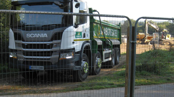
Image shows old shared footpath and cycleway at Penns Field in 2021 shortly after construction of 85 new dwellings commenced.

Hampshire County Council are currently undertaking a design study nearby to improve Pulens Lane thereby enabling more people to walk and cycle. This investment in active travel provision in Pulens Lane will be far more effective if it is complemented by a good route across Penns Field.
The proposed width of a footpath which will connect homes on the eastern side of the development is another concern, as it could be so narrow that it hampers pedestrian movement. It should be constructed to follow guidance by the Government and by Hampshire County Council.
PeCAN have also submitted recommendations about biodiversity, the planting scheme and the Landscape Management and Maintenance Plan.
Objections can be posted on the South Downs planning website under this reference: SDNP/22/05410/CND or click here for a direct link.
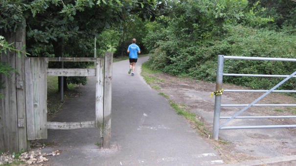
Image shows old shared footpath and cycleway crossing Penns Field prior to the start of construction.
